


Heres a pick thats both timeless and practical.
- Waterproof and tear-resistant
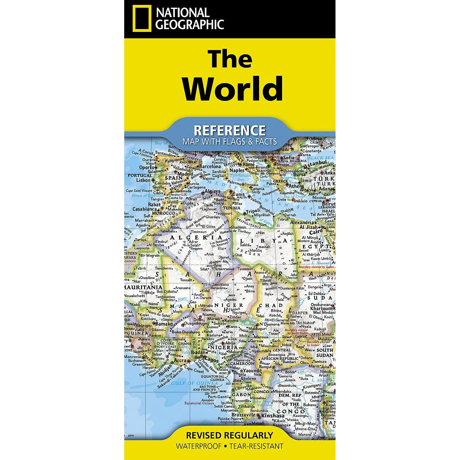
- Signature Classic style map with bright, easy to read color palette with blue oceans and colorful borders
- Background shows mountain ranges and valleys in subtle shaded relief with mountain ranges labeled
- Major water bodies including rivers, lakes, glaciers, oceans, seas, gulfs, bays, straits, and bathymetry
- Clearly defined international boundaries, cities, islands, airports, and physical features
- Thousands of place names carefully and artfully placed to maintain legibility in heavily populated areas
- Up-to-date international boundaries and territorial control reflect de facto status on the ground
- Meticulously researched using multiple authoritative sources including the U.N., U.S. Board on Geographic Names, and policies of individual governments.
- Accurate place names use a combination of conventional English names, official national names, and standard transliterations for non-Latin alphabets.
- National facts and flags with each country's area, population, capital city, GDP per capita, and flag
- Folded size: 4.25 x 9.25 in
- Sheet size: 37.75 x 25.5 in
- Map scale: 1:37,213,000
A versatile choice that never feels out of place.


